<script type="text/javascript">
<!--
window.location = “http://southeastforests.com.au"
//-->
</script>
Eden Region Old Path Ways And Trails Mapping Project
2004
From a report by John Blay and Ben Cruse
for Eden Local
Aboriginal Lands Council
Summary
There were several important path ways between Twofold Bay and the High Country of the Australian Alps. These have apparently been used for thousands of years by many people and for many reasons. They were used, for example, by the coast Aboriginal people to go each year to the Bogong ceremonies, just as the inland people went to the coast for whale celebrations. Substantial parts of these ways still exist in wild country, in National Parks and State Forests.
We have focussed our research on the Bundian Way that goes from Twofold Bay through Towamba and the old Pericoe Road via the Bundian Pass to Delegate and Byadbo to the Snowy, thence the Pinch and on to either Omeo and Gippsland or the alpine country.
The full potential of this way in cultural and tourist terms is yet to be assessed, but when coupled with its biodiversity, which runs in one generally natural sweep from the coast to the highlands and is dominated by a single genus, the eucalypt, that reveals remarkable variation along the way, it could well deserve to be ranked as world heritage.
From old maps and journals we have been able to
compile a map of old path ways and trails in the Eden/Bega Valley region
to show the general historic context or our researches.
In short, the more we have gone into the historical sources the more the ways become certain. Similarly, the more they are investigated on the ground, the more evidence we discover. Therefore it is desirable to investigate them more both on the ground and in further research. It is vital to conserve, preserve and manage what still remains.
Many fascinating questions have arisen from our studies and further research will be immensely rewarding, but the most urgent task is to map the path ways in more detail to allow appropriate management and preservation.
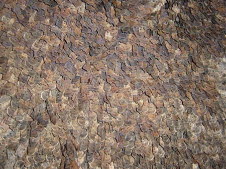
In summer Bogong moths cluster on the walls of granite crevices and caves along the crest of the Australian Alps. They were a significant food source and brought people from as far away as the coast to gather for important ceremonies.
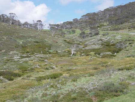
The sub-alpine meadows and woodland about Dead Horse Gap were important camping places for the Kooris during the moth season in summer.
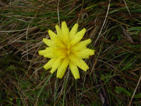
Murrnong, Microseris lanceolata, one of the yam daisies, was an important food source for people making their way to and from the moth ceremonies.
Researches have continued since 2004 culminating in an updated report from the 2010-2011 survey project, now available in PDF format. Work nonetheless continues on this amazing pathway...